
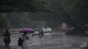
 Chennai: The Chennai Meteorological Centre has issued a report indicating the likelihood of a new low-pressure area forming today near the Andaman Islands in the Bay of Bengal.
This development comes as the Southwest Monsoon has slowed down, leading to dry weather in most parts of Tamil Nadu over the past few days, although some districts have continued to experience moderate rainfall.
Weather Observations
According to the report, an atmospheric circulation is currently observed at an altitude of 5.8 km above sea level over the south-central Bay of Bengal. Following this, a new low-pressure area is expected to form in the central-east and northern Bay of Bengal regions today. This system is likely to move towards northern Andhra Pradesh and Odisha.
Impact on Tamil Nadu and Puducherry
Due to variations in wind speed from the west, parts of Tamil Nadu and Puducherry are expected to experience strong winds at speeds of up to 40 km/h, accompanied by thunderstorms and moderate rainfall today and tomorrow. Additionally, between August 31 and September 3, moderate rainfall is anticipated in some areas of Tamil Nadu and Puducherry.
Marine Warnings
The report also includes warnings for fishermen and those in coastal areas. Strong winds, reaching speeds of 45 km/h and occasionally up to 55 km/h, are expected in the Gulf of Mannar, Kumari Sea, the southern Tamil Nadu coast, the northern Andhra coast, the southern and northern Bay of Bengal, and the northern Andaman Sea regions today and tomorrow.
In the central Bay of Bengal, gale-force winds with speeds of 55 km/h, occasionally reaching up to 65 km/h, are predicted for today. As a result, fishermen are advised to avoid venturing into these areas.
The formation of this low-pressure area and the subsequent weather conditions underline the need for caution, particularly for those in coastal regions and for fishermen. The Chennai Meteorological Centre’s advisory serves as an important alert for the potential impacts over the coming days, urging preparedness and caution to mitigate any risks associated with the expected weather developments.
